NORTH HILL CAMP
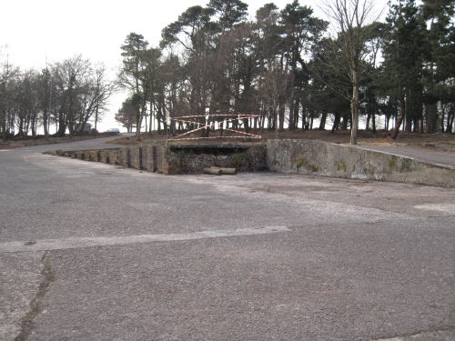
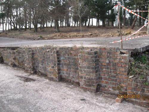
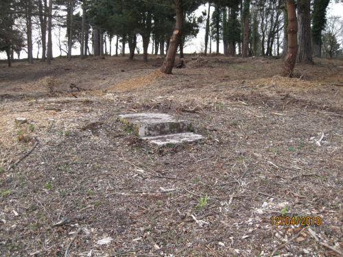
BELOW ARE THE REMAINS OF CAMP ON NORTH HILL
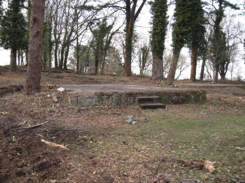
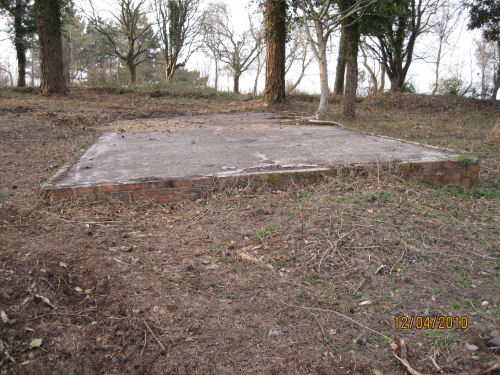
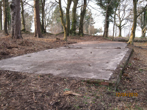
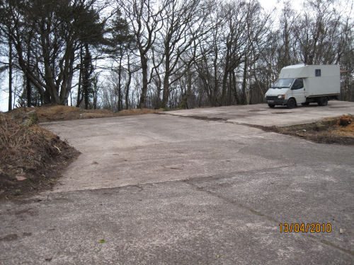
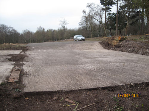
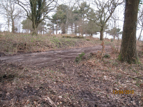
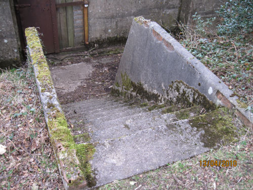
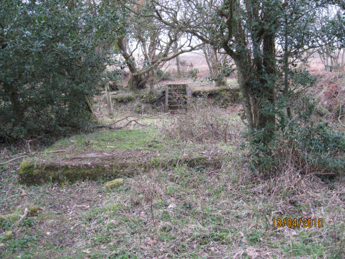
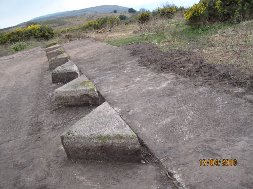
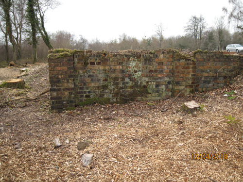
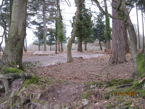
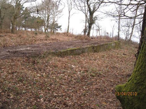
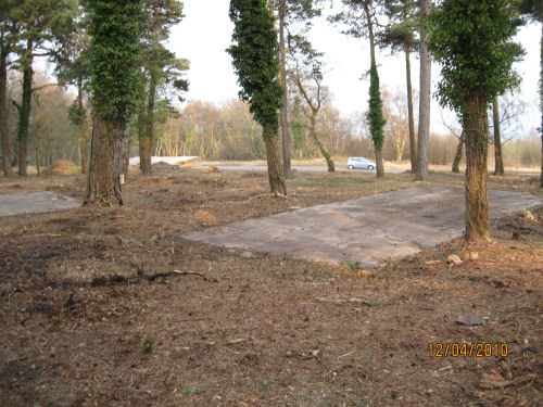
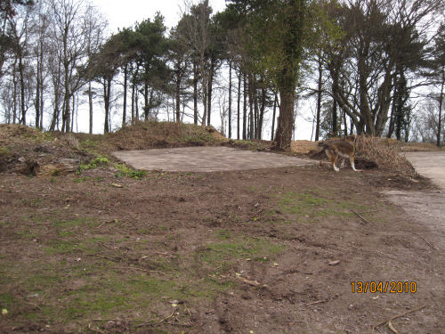
I took these pictures right after it was cleared in 2010 - before it was altered
by adding concrete triangles and fencing.
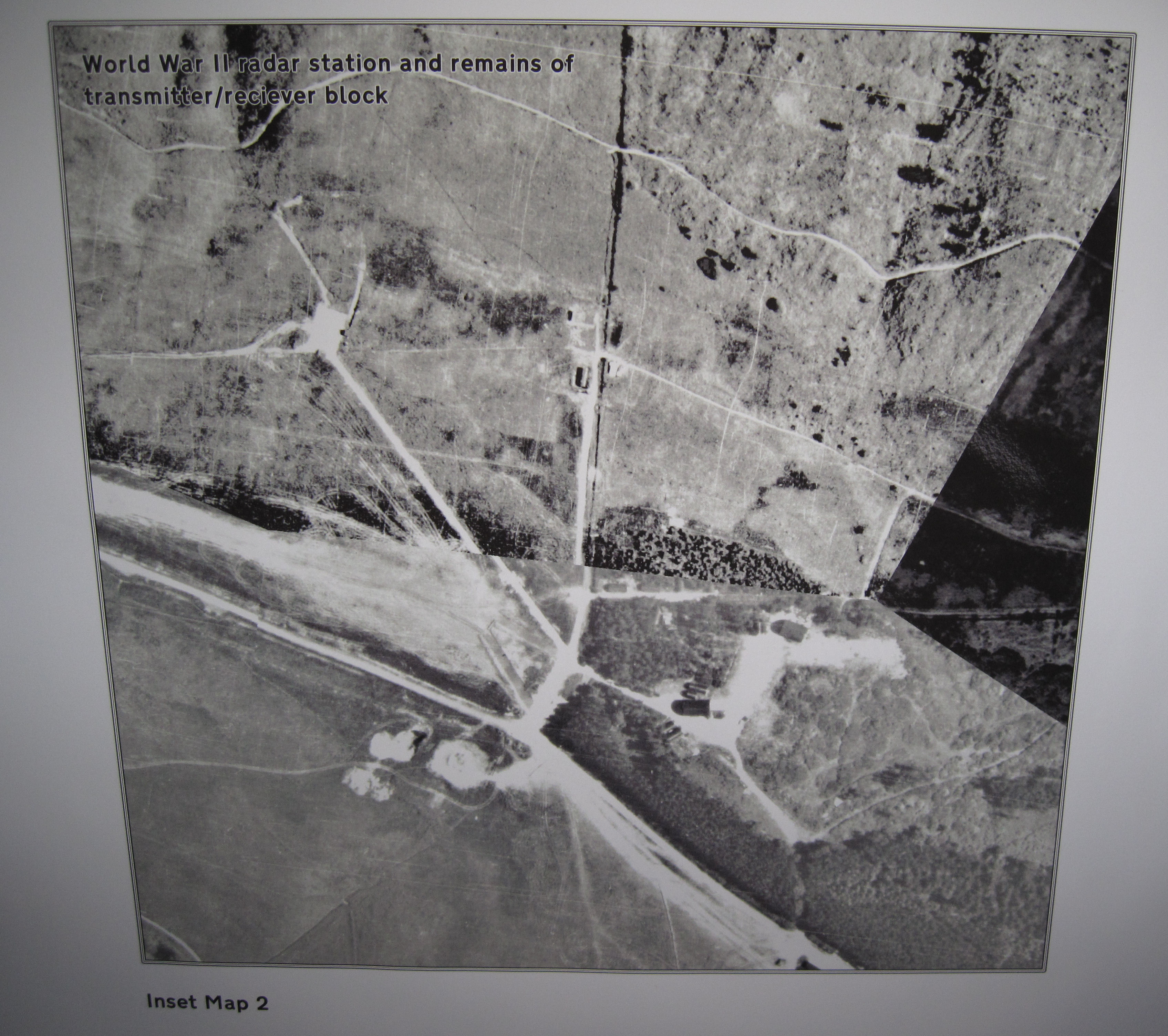
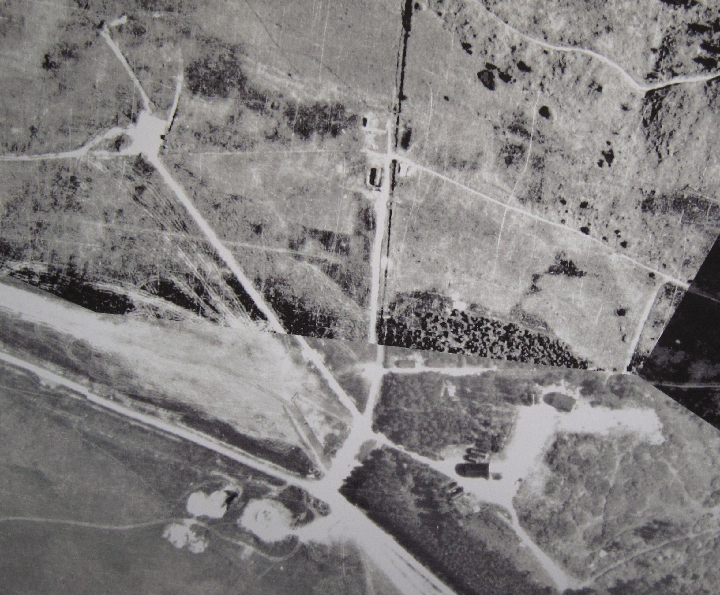
RCHM SURVEY - DATE UNKNOWN
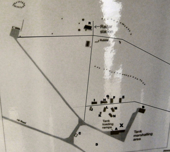
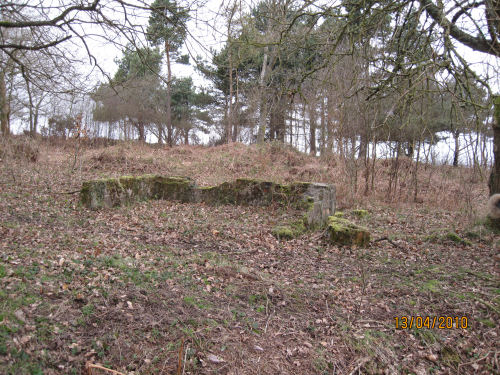
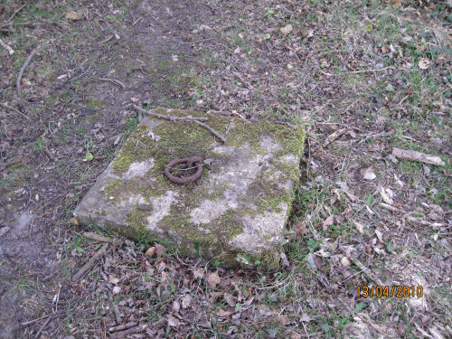
this building not shown on the survey (X)

When the British army moved out in 1943 the Governor General Foot Guards of Canada's 4th Armour Division took over the range and fifteen Sherman tanks arrived by rail and were driven up to North Hill as the corners leading up to the hill were too tight for transporters.
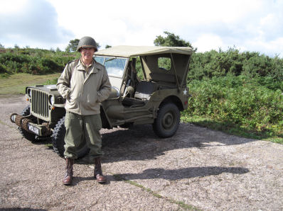
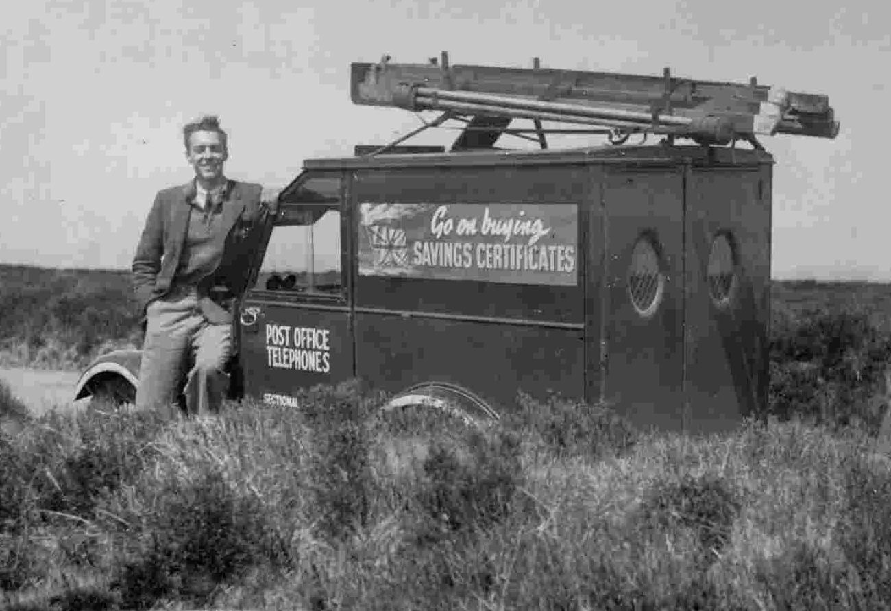
Below is a picture of Dave with his Post Office van taken on Winsford hill in 1941 or 1942
I was born in 1923 in Minehead. My father had a china shop in Quirke Street (I think the number was 18 - next door to Mr Stradlings fish & chip shop which was no.16) later it became the Red Shoes Academy, run by Mr and Mrs Reg Howard. Later we moved to Friday Street, next to Barclays Bank. Our shop was called Lloyds Arcade. Later changed to the Arcade Stores so it wasnt confused with Floyds.
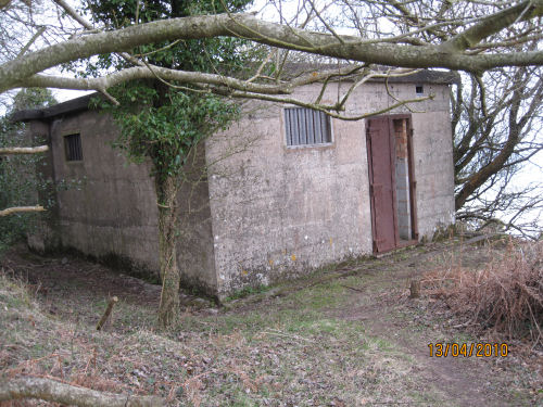
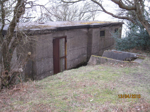
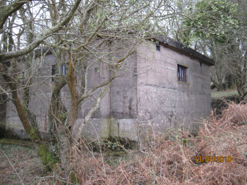
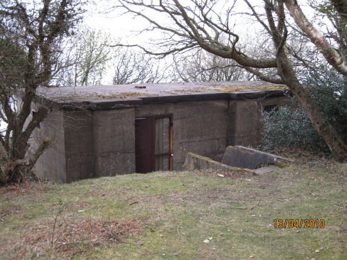
Anyway, it must have been around July/August of 1941, I remember the weather was great and very hot. I had been assigned the job of setting up the Private Line connection at the training camp on North hill. I suppose I was extremely lucky, not to have been called up at 18 and to be one of the few civilians to be allowed in to that very hush hush building, which is the only building that is still standing on North Hill - the Radar station. If I recall correctly, the Defence ministry used Burgess and Co. as the builders.
Being in the communication trade I was reserved until 20 before being conscripted, and of course we only had wireless(radio) and telephones, television was just being tried out in London, in fact one of the pioneers was John Loggie Baird, and my father used to tell me that his wife used to chat with him in our shop in Friday Street. Her husband had evacuated her to Minehead with the children and they had a house or accommodation on North Hill.
As I was saying, I was given the job to make up a small Telephone board to take up and fit in this newly built very hush hush building on the hill.
There were temporary Army type Nissen huts, used for vehicle (Tanks) maintenance, cooking etc., the guys were mostly staying in the larger Hotels and Houses and Pubs which were all taken over by the Army. As far as I can remember all those in the Avenue were commandeered including the Pier Hotel. (now called the Old Ship Aground).
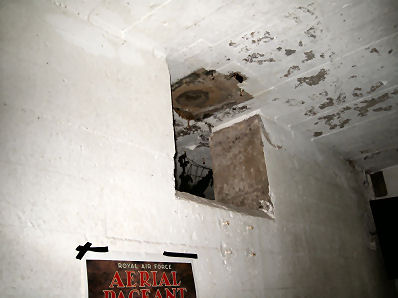
The building that is still standing on North hill was a rushed concrete single storey building with double doors of solid iron, all internal walls were lined with cork and it had a large hole in the centre of the flat concrete roof. There were no trees around it then, just a little flat grassy patch, all the doors and small windows had heavy steel shutters inside and there were guards on duty at the doors.
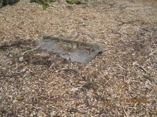
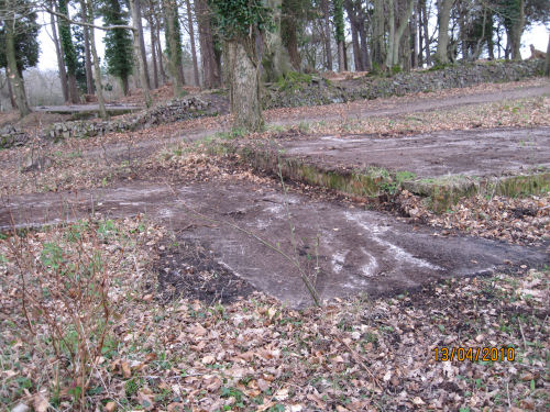
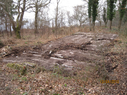
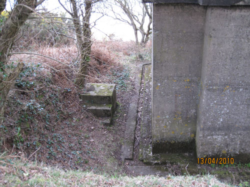
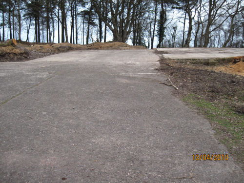
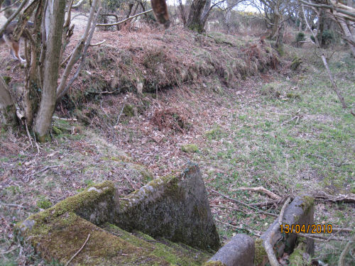
This building is just at the edge of the Rhododendron Wood (now mostly cleared) and about 500 yds. down to the Seaward side overlooking the channel and really not far from Geeenaleigh Farm below. There were many Nissen type huts in the Rhododendron wood which was very overgrown and kept them well hidden. The concrete foundations are still in evidence - as can be seen in the pictures above.
I recall the power had to be heavy 3 phase and new poles were erected from the top of North Hill to the overhead lines near Breaklea Steps. That was the bus stop name on the Porlock Road, it is exactly opposite the turning off to Luccombe, at the bottom of Tivington hill. Evidently that was the nearest they could connect to High voltage electricity from the Porlock supply.. I have been looking on the Google Street view where it takes you down the concrete drive towards the Tank store and washing area. Where you would turn right into it, there is a GPO pole, this was the underground feed to the Station.
Later, after connecting the phone which was a direct Private Line to Hartland Point and seeing it worked, I had the chance to watch the operator of the Radar Screen which was quite small and green and about 15/18” in diameter. The hole in the roof was feeding an oblong oscillating* antenna. (see correction *)If I am right it was controlled by the Royal Navy with Navy personnel and was to pick up movements in the Bristol Channel of boats or more likely submarines. It was all very exciting at the time as none of the general public knew about Radar. We had to adhere to the slogans everywhere telling us to “Be like Dad-keep Mum” or “Remember the Walls have Ears.”
I believe the building was divided off and all the Power and transformers were separate from the Control room which was dark and totally lined with cork tiles, the wall facing towards Selworthy(West) had the Console and operator watching the round Green Ocilographe screen about 15-18” in diameter, the wall facing channel had many grey cabinets with humming valves etc. On the left was an officers desk and more gizmos.
My set up for Telephone Private Line to Hartland Point was fixed to the wall near the corner to the right of the Console, I often wondered what was at the other end of that Line in Hartland Point,was it another similar Radar station? I have also remembered that the Rectangular Mesh Antennae *on the concrete roof was a fixture and not oscillating, as I was given a chance to view the screen and it was pointed out to me the outline of Welsh mountains in distance, this was all quite fantastic at that time.
UPDATE: I think I have found the answer to my years of wondering where the other end of that Private Line I fitted at the Radar Station terminated. It seems that the Hartland Point end of it was into a 1941 Naval VHF Intercept station for “Y” Service, which was a feeder for the now renowned Enigma at Bletchley Park. It was operated jointly by Navy, Army, Air Force, Police and GPO.
This is a very interesting site: RAF Hartland Point ('HAT') R8 GCI ROTOR Radar Station also similar station building to ours can be seen here
The pictures (shown above) bring back vivid memories of the activity going on at the time. The largest concrete area was for hosing down the tanks after action over Selworthy Beacon, at the end of practice, but the wood was so different, totally enclosed by trees and Rhododendrons bushes, the flowers were wonderful.
I laugh when I think of the time self and pals were watching a film at the Regal, when the lights came on and Sammy Jay (the manager) made an announcement that all Canadian troops in the audience had to immediately report back to Headquarters. It turned out later that another convoy of Tanks had arrived by low loader on rail at Minehead station, but that the Tank driver of one was sitting with a girlfriend in the audience, and had paid a buddy to drive it off the rail wagon to a transporter, but not being trained, he had driven in off the wagon onto the lines on its side !!
With regard to your comments regarding the Plume of Feathers, we always thought that it was sacrilege to get rid of that Historic centrepiece. We watched by Floyds as they tried to demolish it. The walls were a fantastic thickness and took ages to break down, just to think we pay Planners millions to prevent this sort of thing happening - then they sanction it!
Its so odd to find that the” powers that be” should say that the original early one that I worked in, did not exist because its not shown on the official maps! The one built later for the RAF at West Myne was built in the 1950,s - there was nothing there during the war. I am certain that this one was Royal Navy run and used for scanning the channel. There were never any heavy overhead power supply towards West Myne or telephone connection, in fact Radar was so new and secret that I think there were very few stations built,other than on the SE and South Coast of Britain.
UPDATE: I emailed Bob Jenner at Subterranea Britannica to ask about the date of the radar station at West Myne and the radar station building still
standing on North Hill and this is his reply:
>>In answer to your query regarding the building of "West Myne" radar station,
the National trust agreed the final design and
building commenced in June 1954.
It was completed in January 1957 and was placed in Care & Mainenance. It was not
required for "1958 Plan Ahead" programme and was demolished
without operational
use.
The image of the building (that is still standing) is that of "Minehead" CD/CHL (CD = Coast Defence[Army]) and (CHL = Chain Home Low[RAF]) The RAF took over all
the Army CD radars. It was most certainly there during WW2 whereas West Myne was not. <<
The basic technology of radio-based detection and tracking evolved independently and with great secrecy in a number of nations during the second half of the 1930s. At the start of the war in Europe in September 1939, both Great Britain and Germany had begun the deployment of these systems. In Great Britain this technology was called RDF, standing for Range and Direction finding, while in Germany the name Funkmessgerät (radio measuring device) was often used.
By the time of the Battle of Britain in mid-1940, the Royal Air Force had incorporated RDF stations as vital elements in Britain's air-defence capabilities. The German Funkmessgerät, could not assist in Germany's offensive capability and was thus not supported by Adolf Hitler. Also, the German Air Force did not sufficiently appreciate the importance of RDF stations in air defence, contributing to Germany's lack of success in this early stage of the war.
Although the technology was first demonstrated in the United States during December 1934, it was only when war clouds loomed that the U.S. military authorities recognized the great potential of radio-based detection and tracking, and began the development of ship and land-based systems. The first of these were fielded by the U.S.Navy in early 1940, and a year later by the U.S. Army.
The acronym RADAR (for RAdio Detection And Ranging) was coined by the U.S. Navy in 1940, and the subsequent name "radar" was soon widely used.
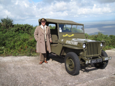
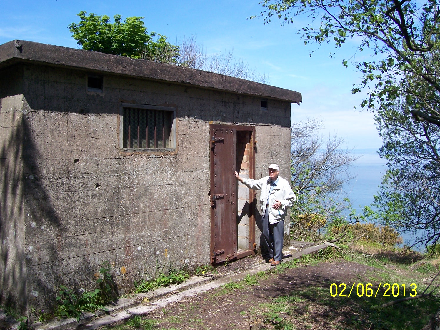
Dave returns to makes a nostalgic visit to the radar station just after his 90th birthday
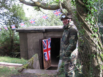
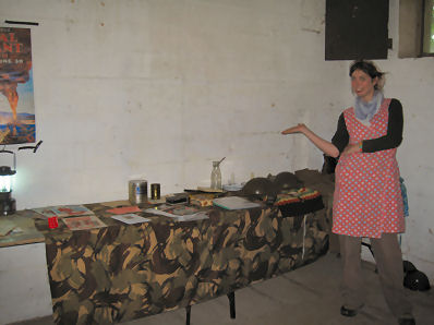
The pictures below from the open day on Saturday 27th Aug.2011 show the inside of the old radar station:
More information about this area can be seen here